


Prospect Township Voting District, Butler County, Kansas
About
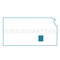
Outline

Summary
| Unique Area Identifier | 584112 |
| Name | Prospect Township Voting District |
| County | Butler County |
| State | Kansas |
| Area (square miles) | 84.86 |
| Land Area (square miles) | 79.11 |
| Water Area (square miles) | 5.75 |
| % of Land Area | 93.22 |
| % of Water Area | 6.78 |
| Latitude of the Internal Point | 37.83253300 |
| Longtitude of the Internal Point | -96.75892550 |
Maps


Graphs
Select a template below for downloading or customizing gragh for Prospect Township Voting District, Butler County, Kansas


Neighbors
Neighoring Voting District (by Name) Neighboring Voting District on the Map
- Chelsea Township Voting District, Butler County, KS
- El Dorado Township Voting District, Butler County, KS
- El Dorado Ward 2 Precinct 1 Exclave A, Butler County, KS
- El Dorado Ward 2 Precinct 1 Exclave B, Butler County, KS
- Glencoe Township Voting District, Butler County, KS
- Little Walnut Township/Leon Voting District, Butler County, KS
- Rosalia Township Voting District, Butler County, KS
- South Salem Township C04 Voting District, Greenwood County, KS
- Spring Creek Township Voting District, Greenwood County, KS
- Spring Township Voting District, Butler County, KS
Top 10 Neighboring County Subdivision (by Population) Neighboring County Subdivision on the Map
- El Dorado city, Butler County, KS (13,021)
- Prospect township, Butler County, KS (2,429)
- Little Walnut township, Butler County, KS (1,044)
- El Dorado township, Butler County, KS (1,039)
- Rosalia township, Butler County, KS (631)
- Chelsea township, Butler County, KS (267)
- Glencoe township, Butler County, KS (202)
- Spring Creek township, Greenwood County, KS (109)
- South Salem township, Greenwood County, KS (95)
Top 10 Neighboring Place (by Population) Neighboring Place on the Map
Top 10 Neighboring Unified School District (by Population) Neighboring Unified School District on the Map
- El Dorado Unified School District 490, KS (14,422)
- Eureka Unified School District 389, KS (4,508)
- Bluestem Unified School District 205, KS (3,834)
- Flinthills Unified School District 492, KS (1,429)
Top 10 Neighboring State Legislative District Lower Chamber (by Population) Neighboring State Legislative District Lower Chamber on the Map
- State House District 75, KS (21,740)
- State House District 78, KS (20,447)
- State House District 70, KS (20,195)
- State House District 13, KS (17,996)
Top 10 Neighboring State Legislative District Upper Chamber (by Population) Neighboring State Legislative District Upper Chamber on the Map
Top 10 Neighboring 111th Congressional District (by Population) Neighboring 111th Congressional District on the Map
Top 10 Neighboring Census Tract (by Population) Neighboring Census Tract on the Map
- Census Tract 202.01, Butler County, KS (7,176)
- Census Tract 201, Butler County, KS (6,253)
- Census Tract 9656, Greenwood County, KS (2,162)